ViaMichelin Europe GPS Software
Product Quality
Value For Money
ViaMichelin Europe GPS Software
When you purchase through links on our site, we may earn an affiliate commission. Here's how it works.
User Reviews
Value For Money
Product Quality
Viamichelin Europe Gps Software Has Easy To Read A
ViaMichelin Europe GPS Software has easy to read and instructions clear.
But there are no map updates unless you buy complete software from via michelin also on side roads unit tends to lock up as maps are not accurate enough.
I thought it was a good buy until i needed updates
Value For Money
Product Quality
I Have An X-960 And I Have Discovered A Bug.
I have an X-960 and I have discovered a bug.If you enter a small village near a big town, then select 'TOWN CENTER' it will take you to the town centre of the next biggest town, not the the one you tapped in!! I informed viaMichelin of this problem, this is their response:Dear Sir,Thank you for your interest in the ViaMichelin Navigation X-960 portable GPS system.Unfortunately this is an error in the route calculation.As there will be no more updates, this problem will not be solved in the future. And I assume that will apply to all models using that software.It's a shame, apart from the slow signal pickup that others have noticed this is a good value GPS.
My Advice - Go Elsewhere - Spend Your Hard Earned
My advice - go elsewhere - spend your hard earned on navigation software that works. Michelin Via Michelin Europe - GPS Software's attempt at getting into that market fails abismally...
I entirely agree with this review. The product is very disappointing. I would suggest that Viamichelin looks at Garmin to know what an efficient GPS can do.
Value For Money
The Review Is Based On Mapsonic Ver 1.32 Running O
The review is based on MapSonic Ver 1.32 running on a Palm Tungsten T3 (PalmOS 5), with the Mapstore part running under Windows. When you purchase the software it doesn't give the version number so it's difficult to know if you are getting this version or not. The screenshots are from Windows (sized to make it look like you would see on a PDA). Most of this is done on the United Kingdom and IE Maps, although I've also used the GPS in the Netherlands. Most of Europe is included on the install Cd's.
Installation onto the PC and the PDA went smoothly, swapping between the 4 Cd's as prompted. Not all Cd's are used in the install, as some just contain specific country maps. Once installed the maps for the countries selected during install are included on the PC, but no maps exist on the PDA. To put a map onto the PDA it needs to be exported from the PC software. This is where the first problem occurs. The PDF manual provided is completely inadequate, and doesn't properly explain the steps in transferring the maps to the PDA. Whilst it was possible to export a very small map direct to the PDA (a county or so), it is not feasible to transfer large maps in that way. A full map of the UK is several hundred MB and cannot reliably be transferred down a link cable to the PDA. The manual explains that it is better to transfer files directly to the PDA's SD card using a card reader, but fails to mention that you have to choose a different format for the files when transferring yourself. I wasted an awful lot of time making sure that I'd used the correct path names, and that the files were correct before finding this. Unfortunately this is just one of the ways in which the manual is inadequate.
When choosing the area to export, you can select which areas will include full details (ie. all roads), and which areas to only include main roads. This is fine if you are going to create a new map for every single journey, but the way I want to use the PDA is to keep it with the map, so that when I need to use it I just put in my destination without having to be at the PC. Unfortunately this means that to create a map of the whole of the UK the map would be very large. Not a problem I thought, as I'd already bought a 512MB SD card which had more than enough space to map the whole of the UK. Unfortunately it turns out that you cannot use a 512MB card, and that the card has to be 256MB (see later). What this means is that someone that travels a lot, that may need multiple cards to contain the whole of England, and if travelling from one part of the country to another, this may involve having to swap cards part way through a journey. A very poor solution, and this needs to be fixed in the software.
Once you've got the maps on the PDA, you can pick departure and arrival points, or go straight to navigation mode and just enter the arrival point. There is no way of adding a Via point which is an inconvenience. When entering the arrival/destination points this can be entered as a city, a street (and house number), GPS coordinates, or one of several different Points of Interest. The software can also add details direct from the address book. There is no way to specify by postcode.
One problem if adding by street is that if there are streets with the same name, and town, but different villages, then it doesn't flag these up as different. I've ended up several miles away from where I should have been because it chose the village of Stockingford over Bedworth for example. Some of the points of interest are useful, such as being able to see the local post office and nearby petrol stations, but when it displays hospitals it doesn't distinguish between those with an A&E department, and the displaying of motorway service stations is inconsistent. It would also be useful if additional Points of Interest were included, such as ferry terminals and tourist attractions. Whilst it's possible to add your own Points of Interest, there is no way to synchronise these with the PC, and it's fiddly trying to manage the entries. There are also some roads missing, as a friends street is completely missing off the map despite being an old road.
By choosing the navigation mode (and if using a GPS sensor), the software will calculate all the possible routes. The problem here is that this can take a long time, even for fairly short journeys. It was not unusual to see a "10 minutes" before the calculations were complete. The manual did warn about this, but didn't say it could be improved by choosing "limited calculations" in the settings. After changing that setting it takes much less time, generally 2 minutes or less. Often calculations are done within a few seconds. To select the navigation mode involves two clicks (one to call the menu, the second to select the navigation mode). This should have been easier so that you can use your fingers to switch to navigation mode.
The software supports GPS devices that are physically connected to the PDA, or bluetooth devices. I used a bluetooth device, it worked well, but doesn't remember the name of the device, and it has to be selected every time that navigation mode is selected. When in normal view it's also possible to have the GPS turned on, so for example it can give you your current location on a viewable map. However if you want to switch between using the normal view between GPS and none GPS modes, then this needs to be turned on and off in the software parameters. Very annoying, especially as mentioned, you need to keep selecting the GPS device, and if it doesn't exist you get asked again every few seconds.
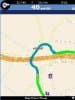
When in navigation mode it works well (except for stability problems see later). You start driving, and once driving it will determine the best route to take. If you start off and have the option of turning left or right, then it doesn't tell you initially which direction, but then corrects you if you make the wrong choice. Unlike other GPS devices I've tried, it doesn't often tell you to make a u-turn, instead finding a route that would allow you to change direction (e.g. turn right - turn right etc... until you are facing the right way, or to go completely around a round-about). The instructions are usually clear, although sometimes one message will prevent another from being spoken. E.g. a round-about with a bend on the approach might be busy telling you "turn slight left" to tell you which exit you will need on the round-about. It also struggles sometimes with the number of exists on a round-about, sometimes missing an exit, and sometimes counting an entry and exit to the round-about as two different exits. The images are clear and when used with the spoken directions make it easy to navigate. There is a night mode that reduces the glare of the screen, and a 3D mode, although I think the 3D mode is more of a gimmick than a useful way of navigating, but at least it's a feature you can just leave turned off.
When entering an arrival point etc... then it uses a big keyboard that allows you to enter the address using your fingers rather than the PDA stylus. This works well for part of it, but there are some tiny drop down menus that need to be selected as well, which are very difficult to navigate without the stylus.
I also used the GPS whilst on holiday in the Netherlands where it was extremely useful. It's hard enough navigating yourself around a country you are familiar with, but it would have been extremely hard without some form of GPS. The main advantage to viaMichelin over competing products, is that you can purchase the Europe edition for about the same price as competing products UK only versions.
The main problem with the software is that it's so unstable when using large maps. I had the whole of the UK on a single map on my 512MB card. It just wouldn't work. The software would crash on a regular basis, locking up the PDA so that it needed a physical reset by pressing in the reset button on the back. This would happen mainly when entering a new arrival point, but also when exiting the application, or sometimes mid journey. I opened a support call, but after a couple of months of asking them to resolve the problem, or provide a fix, all I got was that I'd have to use a 256MB SD card. There also needs to be a significant amount of spare capacity on the SD card. This means that I cannot get the England and Wales on a single card. My current map is of England and Wales, and goes up as far as Cumbria. None of Scotland is included. I still experience too many crashes with this size of map, but considerably less than I had before, which was completely unusable.
There doesn't appear to be any way of getting new maps or program upgrades, except by purchasing the complete software again. As they don't even advertise the version, you wouldn't even know what version that would be. The maps are already looking dated, not taking into consideration the rerouting of the A1 in Yorkshire, the M6 Toll Road in the Midlands, and the moving of the A34 near Newbury, are just a few examples.
Apart from the size restriction on the SD cards, and the quality of the PDF manual, most of the issues are fairly minor ones. However these two issues are unacceptable and ruin what could have been a good product.
If you do a lot of long distance driving, then this is not suitable. Until they provide a version that can handle the whole country on a single card, then it's very difficult to use. If however you don't mind having to swap cards (obviously finding somewhere to pull over), and need the whole of Europe, then this does have some cost savings over other software.
If you do choose this software, then you can expect a painful experience with the provided manual, and with the limitations and annoyances in the software. It does however do a fairly good job of navigating between two points.
Youre being far to kind to what I class as a poor second rate piece of software
Q&A
There are no questions yet. Be the first to ask a question.